Itoshirogawa River, Itoshiro |
 |
| Itoshiro is located in the south foot of Mt.Hakusan. It had prospered as village of mountains religion at one time. |
 |
 |
 | |
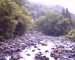
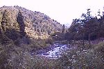
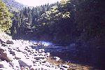
| Shallows of upper stream |  |
 | |
 | |||
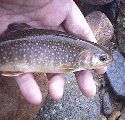
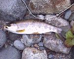
| Near Hakusan shrine | Iwana and Amago | ||
 |
 | ||
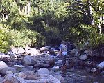
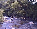
| Tenkara fisher in branch | 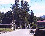 | ||
 | |||
| Stream near Kamizaisho | Hakusan shrine | ||
 |
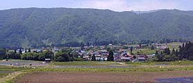 | ||
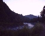
| Flyfisher in the confluence | Distant view of Shimozaisho village | ||
|
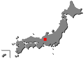
There are a way of going to Route 156 and go up north along the Nagara River
and change its course to northwest past Shirotori town and through Hinoki mountain pass
and the other way of through Izumi village from Fukui pref. Itoshiro is located in the south foot of Mt.Hakusan that is one of three famous mountains with Mt.Fuji and Mt.Tateyama in Japan. This area has rich nature which have many animals, plants of high mountain and natural forest of beech trees. At one time, Itoshiro had prospered with history of religion in Mt.Hakusan since Mt.Hakusan was developed as an ascetic practices location by Priest Taicho in 717. The Itoshirogawa River and that tributary streams are known as good fishing place. The Itoshirogawa River is light and open stream. I feel like fishing at ease there as I enjoy stream and that fine view. In August, 2000, C&R area was established in the Togegawa River of the branch. It aims at the river that the trout reproduced in nature live, not stock. Also, some areas are closed to fishing. |
Flies |
Equipment |
| Back to Main Home Page | Profile | Links |
Home |
Paper Craft of Japanese Trout and the World Trout © 1997 Yoshikazu Fujioka |